Forecast Example: Hurricane Joaquin at 06 UTC 01 Oct 2015
Okay, So What Am I Looking At? Additional Details - The Ensemble Used Additional Details - How Often Do the Tracks Update?
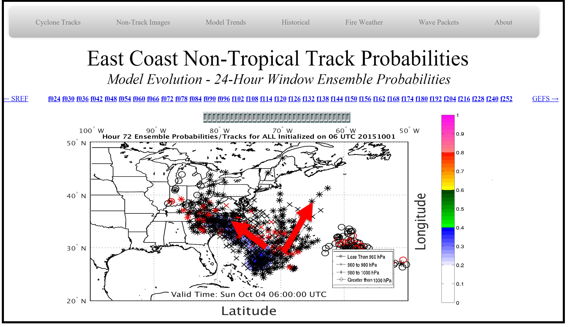
These "Moving Window" graphics display all cyclone tracks within 24 hours of the valid forecast time. The center of the "window" is emphasized in red to eludicate ensemble spread with regard to cyclone timing and position.
The image above shows Hurricane Joaquin ensemble forecast tracks for all ensembles initialized 06 UTC on 01 October 2015. The image above is centered on forecast hour 72; therefore ensemble tracks are plotted between forecast hour 48 and 96, with all track positions at hour 72 highlighted in red. At this time, the "Moving Window" tracks suggest two possible tracks for Joaquin; a landfall in the Carolinas or a track well out to sea. This is highlighted in the red arrows. Given the image above, a track up the coast into the Northeast United States looks unlikely.
The forecast evolution of cyclone tracks can be advanced by mousing over the forecast hour in blue above the image. Model tendencies (i.e. trends) can be assessed by clicking on that forecast hour, as explained in the Model Trends How-to.
The cyclone (or storm center) positions plotted on this site consist of ALL (every forecasted model track), the Global Ensemble Forecast System (GEFS), the Canada Meteorological Center (CMC) Ensemble, the Fleet Numerical Meteorology and Oceanography Center (FNMOC), the Short Range Ensemble Forecast System (SREF), and a collection of operational single-run models (OPER). Currently OPER only plots the United Kingdom Meteorology (UKMET) model. Future additions to OPER will include the operational Alaskan Mesoscale Forecast System (NAM), the Global Forecast System (GFS) and the operational CMC.
The modeled forecast tracks update as soon as they become available. The GEFS and SREF ensembles update four times a day from their 00 UTC, 06 UTC, 12 UTC and 18 UTC runs. The CMC, FNMOC and UKMET update twice a day from their 00 UTC and 12 UTC runs. Cyclone track data for the SREF, GEFS, UKMET, NMMOC and CMC are available about 5, 7, 7, 8, and 10 hours after model initialization, respectively.